More information


The Camino de Levante

A special route for pilgrims and nature lovers, complete with legends, spirituality and culture, providing harmony for body, mind and faith.

Camino de Levante

The first Path of the Cross of Caravaca that has been enhanced, taking advantage of large infrastructures adapted for non-motorized transit, such as the river Segura embankment and the Northwest Greenway, is the Levante Path. It begins in Orihuela, in the Valencian Community, and after passing through Beniel, the city of Murcia, Molina de Segura, Alguazas, Campos del Río, Albudeite, Mula, Bullas, and Cehegín, it reaches Caravaca de la Cruz. This route covers almost 118 kilometers, combining religious significance with culture, nature, gastronomy, and the heritage of the interior of the Region of Murcia.

Stage 1: Orihuela-Murcia

Stage 1: Orihuela-Murcia

More information
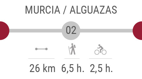
Stage 2: Murcia - Alguazas

Stage 2: Murcia - Alguazas

More information
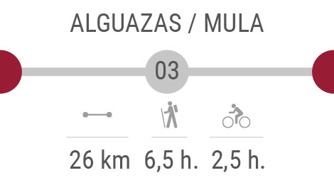
Stage 3: Alguazas - Mula

Stage 3: Alguazas - Mula

More information
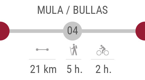
Stage 4: Mula - Bullas

Stage 4: Mula - Bullas

More information
Stage 5:Bullas -  Cehegín - Caravaca de la Cruz

Stage 5:Bullas - Cehegín - Caravaca de la Cruz

More information

STAGES

Orihuela - Murcia: along the Banks of the River Segura

Distance: 24 km
Walking time: 6 hours
Cycling time: 2 hours 30 minutes


See the map of this section Stamping points in this section Stations of the Jubilee in this section Affiliated establishments in this section Where to eat in this section Where to sleep in this section


Download this section in PDF format     Download KML     Download GPX

It's a six-hour walk from Orihuela to Murcia, or 24 kilometres to be more precise, and in general this first stage of the Camino de Levante is one which is known to give particular pleasure to both pilgrims and other walkers. If you're not in a hurry to reach the City of the Cross, take the time to stray off the main route and be surprised by the wealth of churches, sanctuaries and museums, all of them home to a surprising array of relics within their walls.

Most pilgrims complete the stage in one day, starting in Orihuela, close to the Catedral del Salvador in an area with a large number of religious buildings, ideal for a spiritual journey and one of self-discovery. Those with time to spare will prefer to spend around 8 hours along the route, stopping at the Iglesia de las Santas Justa y Rufina, the archaeological museum and the house which was lived in by the great poet Miguel Hernández, all of them in the centre of Orihuela (which is in the province of Alicante).

From here signposts take you across country into the Region of Murcia, where the route follows the River Segura. This is one of the most vital features of the region, and the Tajo-Segura water supply canal can be seen shortly after passing Beniel. One of the last outlying districts before reaching the city of Murcia is El Raal, a quiet place which has nowadays become a dormitory town outside the regional capital.

Throughout this stage, keep your camera close at hand, especially if you are completing the Camino de Levante at Easter or Christmas or during September, when the Moors and Christians festival is held. Unless you have witnessed these annual fiestas, the water wheels of the "huerta" farmland and the Living Nativity Scene of El Raal, you can't really say you have seen Murcia, the city where the stage ends!

Murcia - Alguazas: a walk through the "huerta" arable farmland of Murcia

Distance: 26 km
Walking time: 6,5 hours
Cycling time: 2 hours 30 minutes

See the map of this section Stamping points in this section Stations of the Jubilee in this section Affiliated establishments in this section Where to eat in this section Where to sleep in this section


Download this section in PDF format    Download KML    Download GPX

The Jubilee Year is one of the best times for Catholics to make their peace with God, and the landscape of the second stage of the Camino de Levante on the way to Caravaca de la Cruz is perfect for reflection and contemplation, not only for Catholics but for anyone making the journey. The stage begins in Murcia and ends 26 kilometres later in Alguazas, crossing a wide swathe of the "huerta" of Murcia.

The first part of the route follows the Malecón, named after a construction which was intended to prevent the River Segura flooding in Murcia. Further out of the city, walkers and cyclists discover more secrets of the Huerta, including a museum devoted exclusively to local products and traditions and the large water wheel which has been preserved in La Ñora and which has become the main emblem of the village.

In this area it cannot escape your notice that you are constantly accompanied by perhaps the most treasured element of nature in the Region of Murcia, due to its scarcity: water. Did you notice the irrigation ditches in the orchards leading from the river and the farmers working beneath the hot sun?

The route continues to Molina de Segura, where some will choose to stop and pray, or at least to visit the church of Nuestra Señora de la Consolación, where a place of worship has stood close to the river since the 15th century and is still in perfect condition.

Just in case you don't know anything about the next element on the route, you're now entering the "Vía Verde" or green route. The Vía Verde is an environmental project "recycling" the old railway line towards Alguazas, following the route taken in the past by the railway line to the north-west of the Region of Murcia. Since it was reconditioned as a walking and cycling route this "Green Way" has been used every day by hundreds of people, and if you get lost they will happy to lend a hand!

Alguazas - Mula:castles and the "badlands"

Distance: 26 km
Walking time: 6 hours 30 minutes
Cycling time: 2 hours 30 minutes

See the map of this section Stamping points in this section Stations of the Jubilee in this section Affiliated establishments in this section Where to eat in this section Where to sleep in this section


Download this section in PDF format    Download KML    Download GPX

Each stage of the Camino de Levante has its own character, and this one is marked by the un-irrigated cropland, which will test your mental strength and help you to realize that happiness can be found in the small things in life. Between Alguazas and Mula you cross the "badlands", a harsh and hostile landscape formed by water erosion, although nowadays water. However, travelers are well advised to carry plenty of water in their backpack, tackling a 26-kilometre section to the next port of call.

Pilgrims can also take an alternative route, which not only enriches them spiritually but also helps them to widen their personal and cultural horizons. This detour heads towards Los Rodeos, next to the River Mula, and takes in the ancient settlement of Campos del Río, with its typical village houses and special charm. From here follow the path to Albudeite, where the next church awaits: this one is dedicated to Nuestra Señora de los Remedios, and is unusual in that it is built over the remains of a mosque.

There are plenty of Roman ruins in the Region of Murcia, and many lie along this third stage of the journey to Caravaca de la Cruz. Once you cross the motorway, after Los Baños de Mula, there is the option of taking another detour to the Roman Villa of Los Villaricos, and from there to La Puebla de Mula. This is the site of the Castillo de Alcalá, a fortress where religious beliefs are safeguarded, and once here you can congratulate yourself on having reached the end of the stage in Mula. The Sanctuary of the True Cross is getting closer now...

Mula - Bullas: between landscapes and vineyards

Distance: 21 km
Walking time: 5 hours
Cycling time: 2 hours

See the map of this section Stamping points in this section Stations of the Jubilee in this section Affiliated establishments in this section Where to eat in this section Where to sleep in this section


Download this section in PDF format    Download KML    Download GPX

Your faith has brought you as far as the penultimate stage of the Camino de Levante, and although this one is shorter at 21 kilometres, it is also more strenuous. Leaving Mula behind, you set out on a walk (or ride) which will take you through the vineyards to Bullas.

At this point the route is already in the north-west of Region of Murcia. Did you know that this section runs close to the regional park of Sierra Espuña? This is one of the finest natural landscapes of the Region, and it is not uncommon to see golden eagles along the way: keep your eyes peeled, as the wildlife is one of the treasures along the route.

As the route climbs it becomes more testing, with some of the slopes far from straightforward. To avoid getting lost always follow the Vía Verde del Noroeste, which passes through El Niño de Mula , a popular place among pilgrims and a good spot to take refreshment on board and recharge the batteries. The best month to visit here is September, when the locals commemorate the apparition of the infant Jesus to a shepherd. As you can see, this is another manifestation of the miracles and faith impregnating each section of the route.

And then, almost unexpectedly, we arrive in Bullas. Celebrate your arrival by visiting the church of Nuestra Señora del Rosario and the Museo del Vino (Wine Museum): this is a land of vineyards and quality products which have been awarded Denomination of Origin status, and an ideal place to rest up and regain your strength before tackling the last stage of the journey.

Bullas - Caravaca: the end of the Camino de Levante, the Sanctuary of the True Cross

Distance: 21 km
Walking time: 5 hours
Cycling time: 2 hours

See the map of this section Stamping points in this section Stations of the Jubilee in this section Affiliated establishments in this section Where to eat in this section Where to sleep in this section


Download this section in PDF format    Download KML    Download GPX

You are now just one step away from achieving plenary indulgence and marveling at the impressive sanctuary which stands atop the hill of Caravaca, but success still requires a final effort and is hard won. This is the case with the last stretch of this route, the final stage being the hilliest and the hardest, rising by 500 metres along its 21-kilometre length. Fortunately, your faith will fortify you and be your companion on the journey, helping you to complete the task ahead.

Again the route follows the old railway line, this time leading to the Taibilla water supply canal and then, flanked by vineyards and pine woods, to the spot known as Cristo Carrascalejo. This is the location of the oldest winery in Bullas, and at the same time is of religious as well as gastronomic importance as it is where the locals hold a ceremonial foot-kissing of the figure of Christ during Lent.

The Camino de Levante will introduce you to a large number of different locations in the Region of Murcia, and one of the last is Cehegín. Did you know that the characterful old quarter, or town centre, has been declared a historical monument? View its impressive civil and religious heritage by wandering through the narrow streets, and don¿t forget to find out about the ruins of Begastri, an ancient Roman city which was the centre of a Diocese between the 6th and 8th centuries.

At this point, almost without noticing, you have nearly reached Caravaca de la Cruz. Stop, take a moment to look up to the top of the hill, and there, just a few more minutes away is the Santuario de la Vera Cruz. There remains just one more push and you can join the thousands of pilgrims who are there to worship the True Cross. Without doubt, the journey and the effort have all been worthwhile!


Localities

Orihuela

Beniel

Murcia

Alcantarilla

Molina de Segura

Alguazas

Campos del Río

Albudeite

Mula

Bullas

Cehegín

Caravaca de la Cruz

Interactive map

Whether you're planning to do the Camino de Levante, or you've already started and are halfway done, we offer you this interactive map.

See more

Signage

Learn about the different types of markers and signposts along the Camino de Levante so that you arrive at your destination without getting lost

See more

Sites of interest

Discover the places you should visit when you walk the Camino de Levante

See more

Participating establishments

You'll be able to check out the participating establishments, and get information on becoming one of them

See more

Top 10 Camino de Levante

 
Versión accesible